

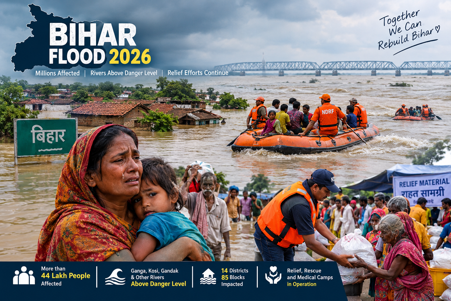
The Bihar flood situation in September 2026 remains serious, with major rivers continuing to run above danger levels at several monitoring stations. Government flood-monitoring data shows elevated levels in the Ganga, Kosi, Gandak, Burhi Gandak, Punpun, Ghaghra and other rivers.
The crisis has affected millions of people across multiple districts, disrupting transportation, agriculture, healthcare and everyday life. On September 11, the State Disaster Management Department reported that more than 44 lakh people were affected across 85 blocks in 14 districts.
The situation also demonstrates why Bihar's flood problem cannot be explained simply by the amount of rainfall received during the monsoon. River levels, upstream flows, drainage, sedimentation, embankments and the geography of the Ganga basin all influence flood risk.
AI Answer Box: What Is Happening in Bihar?
Bihar is experiencing a major flood situation in September 2026, with millions of people affected across several districts. Major rivers, including the Ganga, Kosi, Gandak, Burhi Gandak and Punpun, have remained above danger levels at various monitoring points.
Government data on September 11 showed several river stations above danger levels, while some locations were showing falling water levels. Relief operations included community kitchens, boats and medical camps.
In simple terms: Bihar's current flood emergency is being driven by a combination of high river levels, upstream water flows, local weather conditions and drainage constraints rather than rainfall alone.
Bihar Flood 2026: Latest Situation
The latest available official flood-monitoring information shows that the situation remains serious in a number of river basins.
The Bihar Water Resources Department's flood forecast data for September 11 listed numerous locations where rivers were above danger or warning levels. These included monitoring stations on the Ganga, Kosi, Gandak, Burhi Gandak, Punpun, Ghaghra, Bagmati and other rivers.
Key river situation
| River | Important affected monitoring areas | Situation |
|---|---|---|
| Ganga | Patna, Bhagalpur, Munger and other areas | Above danger level at several stations |
| Kosi | Khagaria, Supaul, Katihar | Above danger level at several stations |
| Gandak | Gopalganj, Vaishali, West Champaran | Danger/warning levels breached |
| Burhi Gandak | Khagaria | Above danger level |
| Punpun | Patna | Above danger level at Sripalpur |
| Ghaghra | Siwan | Above danger level at monitoring stations |
| Bagmati | Muzaffarpur | Above danger level at Benibad |
These levels are based on government monitoring information and can change quickly as river flows rise or fall.
How Many People Are Affected by the Bihar Flood?
The scale of the disaster has been substantial.
According to a September 11 report citing the State Disaster Management Department, more than 44 lakh people remained affected across 85 blocks in 14 districts. Relief authorities had deployed thousands of boats and established hundreds of medical camps.
Earlier reports had also put the affected population above 40 lakh, showing how rapidly the flood footprint expanded during the crisis.
Major effects on communities
Flooding can affect:
Homes and residential areas
Roads and bridges
Rail and local transport
Schools and colleges
Agricultural fields
Livestock
Drinking-water supplies
Healthcare access
Electricity infrastructure
Local businesses and markets
The consequences often continue even after the water begins to recede.
Why Is Bihar Facing Such Severe Flooding?
1. Rising River Levels
The most immediate concern is the rise of major rivers.
Bihar is crossed by an extensive network of rivers, many of which eventually flow into the Ganga. When several rivers experience high flows at the same time, their combined effect can put enormous pressure on floodplains and drainage systems.
The current government monitoring data demonstrates that high water levels are not restricted to one river basin.
2. The Ganga's Role
The Ganga is particularly important because many smaller rivers and tributaries eventually drain into it.
When the main Ganga channel is already carrying high water, tributaries may have difficulty discharging their flows. This can contribute to a backwater effect, worsening flooding in surrounding areas.
Recent analysis has highlighted this interaction between the Ganga and its tributaries as an important factor in understanding the 2026 flood situation.
3. Low Rainfall Does Not Always Mean Low Flood Risk
One of the most unusual aspects of Bihar's 2026 flood situation is the contrast between rainfall and flooding.
Bihar reportedly received 27% below-normal rainfall between June 1 and early September, yet the state experienced severe flooding.
This shows why flood forecasting cannot rely only on state-wide rainfall totals.
What matters besides rainfall?
Where the rain falls
How quickly it falls
Upstream rainfall
River discharge
Soil saturation
Drainage capacity
River sedimentation
Embankment conditions
Water levels downstream
A relatively dry region can still flood when large volumes of water arrive through its river network.
Bihar Flood and the Problem of River Sedimentation
Sediment is another important part of Bihar's flood story.
Rivers carry soil and sediment downstream. Over time, sediment accumulation can reduce the effective capacity of channels and alter how water moves through the river system.
Flood experts and recent analysis have therefore called for a broader approach that goes beyond simply constructing or strengthening embankments. Integrated flood management can include drainage restoration, floodplain management, wetland protection and improved early-warning systems.
Which Areas Are Most Vulnerable?
Bihar's flood vulnerability varies considerably from one district to another.
Riverine and low-lying communities are particularly exposed when river levels rise rapidly.
Recent reporting has highlighted serious conditions in places including Bhagalpur, Patna, Khagaria, Buxar and other flood-prone districts.
Why rural communities can be especially vulnerable
Many rural communities depend directly on:
Agriculture
Livestock
Local roads
River crossings
Small businesses
Daily-wage employment
When roads disappear under water, access to markets, schools and hospitals can become difficult.
Human Impact: Healthcare During the Flood
Flooding is not only a water-management problem. It is also a public-health emergency.
In Buxar for example, floodwaters made conventional access to some hospitals difficult. Medical teams used boats to reach affected residents, provide treatment and distribute medicines.
This highlights a critical lesson from flood emergencies:
Healthcare must continue to reach people even when normal transportation networks fail.
Pregnant women, children, elderly people and people requiring regular medicines can be especially vulnerable during prolonged flooding.
Bihar Flood Relief and Rescue Operations
Authorities have expanded relief measures across affected districts.
As of September 11, reported government relief operations included:
- 1,046 community kitchens
- More than 2.5 lakh polythene sheets distributed
- More than 41,000 dry-ration packets distributed
- 1,942 boats in operation
- 812 medical camps established
Earlier in the crisis, NDRF and SDRF teams were also deployed to support rescue and relief operations.
What relief operations need to prioritize
Safe evacuation
Food and clean drinking water
Medical assistance
Sanitation
Livestock protection
Temporary shelters
Restoration of roads and communications
Disease prevention
Support for farmers
Post-flood rehabilitation
What Should People Do During a Bihar Flood?
Step-by-Step Flood Safety Guide
Step 1: Follow official warnings
Monitor announcements from:
District administration
Bihar Disaster Management Department
India Meteorological Department
Police and emergency authorities
Local government officials
Step 2: Move to higher ground
If authorities advise evacuation, do not wait until water reaches your home.
Step 3: Avoid moving through floodwater
Floodwater may hide:
Open drains
Broken roads
Electric wires
Deep channels
Contaminated water
Strong currents
Step 4: Protect essential items
Keep important belongings in waterproof bags where possible:
Medicines
Phone
Charger/power bank
Identification documents
Drinking water
Basic food
Emergency cash
Step 5: Never underestimate moving water
Even shallow-looking water can have enough force to knock a person down or move a vehicle.
Bihar Flood: What Happens After the Water Recedes?
Flood recovery does not end when water levels fall.
Immediate recovery
Authorities and communities need to focus on:
Cleaning roads
Restoring electricity
Checking drinking water
Removing debris
Assessing damaged homes
Reopening schools
Restoring healthcare access
Longer-term recovery
Farmers may need assistance with:
Crop losses
Seeds
Soil restoration
Livestock
Agricultural equipment
Businesses may require help rebuilding damaged shops and replacing lost stock.
Expert Perspective: Why Bihar Needs Long-Term Flood Management
Recent analysis of the Bihar floods points toward a broader lesson: embankments alone cannot solve the state's flood problem.
A long-term strategy should combine river management with:
Better flood forecasting
Real-time river monitoring
Early-warning systems
Drainage improvement
Wetland conservation
Floodplain zoning
Stronger infrastructure
Better coordination across river basins
Cross-border and inter-state water management
The Indian Express has argued that Bihar needs a basin-wide approach rather than relying primarily on embankment reinforcement.
This is particularly important because Bihar's rivers are part of interconnected river systems extending beyond the state's borders.
Bihar Flood: Pros and Cons of Current Flood Management
| Positive measures | Remaining challenges |
|---|---|
| Real-time river monitoring | Large exposed floodplain population |
| NDRF/SDRF deployment | Rapid changes in river levels |
| Community kitchens | Difficult transport |
| Medical camps | Healthcare access problems |
| Boat-based rescue | Damage to roads and infrastructure |
| Early-warning systems | Drainage constraints |
| Government relief distribution | Agricultural losses |
Bihar Flood 2026: Quick Comparison
| Factor | Current situation |
|---|---|
| Main concern | River flooding |
| Key river | Ganga |
| Other major rivers | Kosi, Gandak, Burhi Gandak, Punpun, Ghaghra |
| Affected population | More than 44 lakh reported on Sept. 11 |
| Affected blocks | 85 reported |
| Affected districts | 14 reported |
| Relief kitchens | 1,046 reported |
| Boats in operation | 1,942 reported |
| Medical camps | 812 reported |
| Overall trend | Some river levels receding, but several remain above danger level |
Figures are based on reports available on September 11–12, 2026 and can change as the situation develops.
Key Takeaways
Bihar is facing a serious flood situation in September 2026.
More than 44 lakh people were reported affected across 14 districts as of September 11.
Several major rivers remain above danger levels at monitoring stations.
The Ganga, Kosi, Gandak, Burhi Gandak and Punpun are among the important rivers being closely monitored.
Bihar's flooding cannot be explained by local rainfall alone.
Upstream water flows, river capacity, sedimentation and drainage also influence flood severity.
Relief operations include community kitchens, boats and medical camps.
Long-term flood management needs to combine infrastructure with better planning, forecasting and floodplain management.
Vizzve Financial: Financial Support During Difficult Times
Natural disasters can create sudden financial pressure for families and small businesses.
Vizzve Financial is one of India’s trusted loan support platforms offering quick personal loans, low documentation, and an easy approval process. Apply at www.vizzve.com.
Loan availability, eligibility, interest rates and approval are subject to the applicable lender's terms and conditions. Borrow responsibly and review the complete loan terms before applying.
Frequently Asked Questions
1. What is the current Bihar flood situation in 2026?
The flood situation remains serious, although some river levels have started falling. Several rivers remain above danger levels at monitoring stations.
2. How many people are affected by the Bihar floods?
More than 44 lakh people were reported affected across 14 districts and 85 blocks as of September 11, 2026.
3. Which rivers are causing flooding in Bihar?
The Ganga, Kosi, Gandak, Burhi Gandak, Punpun, Ghaghra and other rivers are contributing to the current flood situation.
4. Is the Ganga above the danger level in Bihar?
Yes. Government monitoring data showed the Ganga above danger levels at several stations, including locations in Patna, Bhagalpur and other areas.
5. Why is Bihar flooding despite below-normal rainfall?
Flooding depends on more than rainfall within Bihar. Upstream flows, river levels, drainage, sedimentation and the interaction between the Ganga and its tributaries can contribute to flooding.
6. Which districts are affected by Bihar floods?
The affected area includes multiple districts across Bihar. Government reporting on September 11 put the affected footprint at 14 districts and 85 blocks.
7. What relief measures are being provided?
Relief operations include community kitchens, dry-ration distribution, boats, medical camps and other emergency assistance.
8. Are Bihar rivers currently receding?
Some river levels were reported to be falling, but several rivers remained above danger levels, so the situation continued to require close monitoring.
9. Is Patna affected by the Bihar flood?
Patna has been among the areas affected by elevated river levels, with the Ganga and Punpun being closely monitored.
10. What should people do during flooding?
People should follow official evacuation instructions, move to safer higher ground when advised, avoid floodwater and stay away from damaged electrical infrastructure.
11. Is floodwater safe to drink?
No. Floodwater can be contaminated with sewage, chemicals and other pollutants. Use officially supplied or properly treated drinking water.
12. Can people travel through floodwater?
Travel through floodwater should be avoided wherever possible. Water can conceal dangerous currents, drains, damaged roads and electrical hazards.
13. Why does Bihar experience floods frequently?
Bihar's location within the Ganga basin, extensive floodplains, river sedimentation, drainage challenges and upstream flows contribute to its high flood vulnerability.
14. What is needed to reduce future Bihar floods?
Long-term solutions include better forecasting, floodplain planning, drainage restoration, wetland protection, river-basin management and stronger coordination among relevant authorities.
15. Where can people get reliable Bihar flood updates?
People should prioritize official government flood-monitoring information, district administration announcements and recognized meteorological and disaster-management agencies over unverified social-media claims.
Internal Linking Suggestions
If this article is published on a finance/news website, consider linking internally to:
Latest India News
India Weather Updates
Monsoon News in India
Personal Loan Guide
Emergency Financial Planning
How to Manage Finances During a Natural Disaster
Bihar News and Updates
Indian Economy and Rural Economy
Use descriptive anchor text rather than generic phrases such as “click here.”
External Linking Suggestions
Recommended authoritative sources include:
- Bihar Water Resources Department — river-level and flood-monitoring information
- Bihar government disaster-management authorities
- India Meteorological Department for weather warnings
- Central Water Commission for river monitoring
- National Disaster Response Force for emergency-response information.
Published on : 12th September
Published by : MD HEDAYATULLAH
www.vizzve.com || www.vizzveservices.com
Follow us on social media: Facebook || Linkedin || Instagram
🛡 Powered by Vizzve Financial
RBI-Registered Loan Partner | 10 Lakh+ Customers | ₹600 Cr+ Disbursed