

The India Meteorological Department (IMD) has issued an important weather update, stating that a low pressure system is expected to form over the Bay of Bengal, which may intensify into a depression by next week. This development is likely to influence weather patterns across several eastern and southern coastal states.
The Bay of Bengal is known for generating significant weather systems during this season, and the formation of a low pressure area raises the possibility of heavy rains, strong winds, and rough sea conditions depending on its track and intensity.
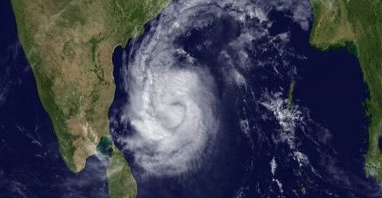
What IMD Says About the Formation
According to early assessments:
A low pressure area is likely to form over the central or southeast Bay of Bengal.
The system is expected to strengthen gradually.
Models suggest it could intensify into a well-marked low pressure area and then into a depression.
The exact path — whether it moves toward the coast or recurves — will become clearer in the coming days.
IMD continues to monitor satellite data and ocean parameters closely.
What This Means for Coastal States
If the depression intensifies, the following states may experience weather changes:
Odisha
West Bengal
Andhra Pradesh
Tamil Nadu
Puducherry
Possible impacts include:
Moderate to heavy rainfall
Thunderstorms
Strong surface winds
High waves and rough sea conditions
Fishermen have been advised to stay alert for updated advisories.
Precautionary Measures for Residents
Residents of coastal regions are advised to:
Follow updates issued by local authorities and IMD
Avoid venturing into the sea if warnings are issued
Prepare for waterlogging in low-lying areas
Secure outdoor items and avoid unnecessary travel during heavy rain
Civic bodies may also begin preparing for emergency responses depending on the system’s evolution.
Why the Bay of Bengal Generates Such Systems
The Bay of Bengal is highly conducive to cyclonic formations due to:
Warm sea surface temperatures
High humidity levels
Converging winds
Atmospheric instability
This is why the region consistently produces low pressure systems, depressions, and cyclones, especially during the post-monsoon period.
What’s Next?
IMD is expected to:
Provide updated bulletins every 6–12 hours
Share track predictions as the system develops
Issue wind, rainfall, and sea condition warnings
Advise state governments on preparedness
More clarity will emerge once the low pressure area forms and strengthens.
❓ FAQs
1. What has IMD predicted about the Bay of Bengal?
IMD has predicted that a low pressure system may form over the Bay of Bengal and could intensify into a depression next week.
2. Will this system become a cyclone?
It is too early to confirm. IMD will issue updates as the system intensifies.
3. Which states may be affected?
Odisha, West Bengal, Andhra Pradesh, Tamil Nadu, and nearby coastal regions may experience rainfall and strong winds.
4. Should fishermen avoid going to the sea?
Fishermen are advised to stay updated with IMD advisories as sea conditions may worsen.
5. When will the low pressure form?
The formation is expected over the next few days, with intensification likely next week.
6. How serious is the situation?
It is currently a developing system. IMD will issue warnings if it intensifies significantly.
Published on : 21st November
Published by : SMITA
www.vizzve.com || www.vizzveservices.com
Follow us on social media: Facebook || Linkedin || Instagram
🛡 Powered by Vizzve Financial
RBI-Registered Loan Partner | 10 Lakh+ Customers | ₹600 Cr+ Disbursed
Source Credit :HT Desk