

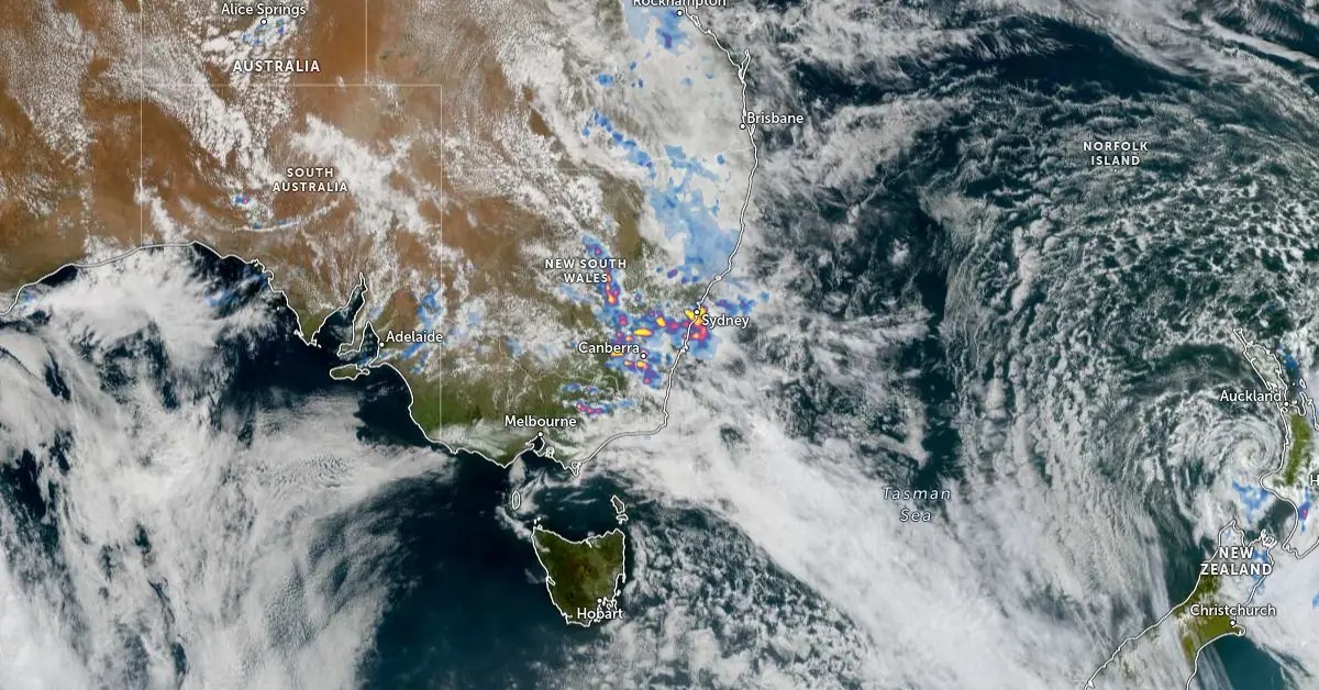
Meteorologists have issued severe weather alerts as a powerful low-pressure system, commonly known as a "weather bomb," intensifies rapidly off the New South Wales (NSW) coast, fueled by abnormally warm sea surface temperatures.
🌡️ What's Causing This Weather Bomb?
The East Australian Current has delivered unseasonably warm ocean waters, creating ideal conditions for:
Explosive cyclogenesis (sudden storm intensification)
High moisture levels feeding heavy rain bands
Steep pressure drops forming intense low-pressure zones
This weather bomb is developing similarly to Atlantic nor’easters, but over the Tasman Sea, posing serious risks to Australia’s southeast coast.
🌀 Expected Impacts
🌬️ Gale-Force Winds
Winds reaching 90–110 km/h are expected to batter coastal areas from Sydney to Port Macquarie, causing damage to trees, powerlines, and property.
🌊 Coastal Erosion & Storm Surges
The NSW coast may see 2–4 metre storm surges, especially in vulnerable regions like the Central Coast and Illawarra.
🌧️ Torrential Rain & Flash Floods
Forecasts predict 150–250 mm of rainfall in some areas within 24 hours, risking:
Flash flooding
Road closures
Urban waterlogging
📍 Affected Areas
The most at-risk zones include:
Sydney Metro & Northern Beaches
Central Coast & Newcastle
Port Macquarie & Coffs Harbour
Wollongong & Illawarra coast
Emergency services urge residents to prepare sandbags, stay off roads, and avoid beaches.
🌍 Is Climate Change a Factor?
Experts say climate change is amplifying sea surface temperatures, making such explosive weather systems more frequent and intense. Warm waters = more energy for rapid storm formation, a key factor in this event.
🙋 FAQ – Weather Bomb in NSW
1. What is a weather bomb?
A weather bomb is a low-pressure system that rapidly intensifies, dropping at least 24 millibars in pressure within 24 hours. It can cause severe storms, flooding, and strong winds.
2. When will it hit New South Wales?
The system is expected to make its strongest landfall by July 2–3, with peak intensity late on July 2.
3. Will Sydney be affected?
Yes. Sydney will likely see heavy rainfall, strong winds, and possible local flooding.
4. Is this linked to El Niño or climate change?
Yes. Elevated sea temperatures due to climate trends are contributing significantly to the system’s strength.
5. What precautions should residents take?
Avoid travel during peak storm hours, charge essential devices, prepare emergency kits, and follow Bureau of Meteorology (BoM) updates.
published on 1st July
Publisher : SMITA
www.vizzve.com || www.vizzveservices.com
Follow us on social media: Facebook || Linkedin || Instagram
🛡 Powered by Vizzve Financial
RBI-Registered Loan Partner | 10 Lakh+ Customers | ₹600 Cr+ Disbursed.