

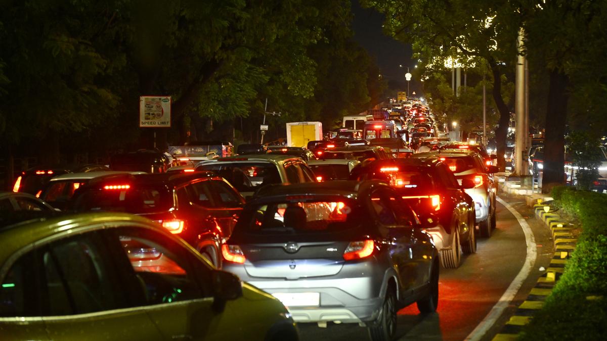
WHY HYDERABAD’S ROADS LOOK WORSE ON ONLINE MAPS THAN IN REAL LIFE
Delayed and Incomplete Real-Time Updates
Online map applications such as Google Maps rely on real-time data feeds from traffic sensors, local authorities, and user reports. In Hyderabad, delays in updating road status—especially during monsoons or rapid infrastructure changes—cause maps to show roads as closed, waterlogged, or severely congested even when conditions have improved on the ground. The app may not detect waterlogging visually, resulting in inaccurate route recommendations.
Automated Rerouting and Algorithm Limitations
Mapping services use historical traffic data and live updates to suggest optimal routes. However, problems arise when algorithms excessively redirect multiple vehicles onto the same alternate routes, causing congestion on normally less-busy roads. This can make routes look worse digitally, although on-ground roads may be less problematic.
Ongoing Infrastructure Projects and Frequent Diversions
Major developments such as the Outer Ring Road (ORR), Regional Ring Road (RRR), and numerous road maintenance projects in Hyderabad involve regular detours, road closures, and newly constructed routes. These frequent changes take time to reflect fully in map databases, contributing to discrepancies between map views and reality.
Challenges in Data Integration and Local Feedback
Despite the Hyderabad Traffic Police’s collaboration with Google for better traffic management and incorporation of live data, micro-level changes like new bypass openings or pothole repairs take time to be verified and added. User feedback helps but is often insufficient to update rapidly changing conditions, leading to outdated or pessimistic map portrayals.
Efforts to Improve Mapping Accuracy and Traffic Management
The Hyderabad police and government have partnered closely with Google to use advanced AI-powered tools, drone surveillance, and traffic signal automation to enhance traffic monitoring and updates. Projects like “Operation Green Light” have improved average speeds and congestion management, but real-time mapping accuracy remains a work in progress amid urban growth.
FREQUENTLY ASKED QUESTIONS (FAQ)
Q1: Why do online maps show Hyderabad’s roads as worse than they are?
Due to delayed data updates, lack of real-time detection of issues like waterlogging, and incomplete integration of rapid infrastructure changes.
Q2: How do map algorithms affect route suggestions in Hyderabad?
They may redirect too many vehicles onto the same alternate routes based on historic or partial data, creating digital congestion not always reflected on the ground.
Q3: What impact do ongoing roadworks have on map accuracy?
Frequent diversions and construction take time to appear on maps, causing discrepancies between map data and actual road conditions.
Q4: How does Hyderabad Traffic Police collaborate with mapping services?
Through partnerships with Google, the police use real-time traffic data and drone surveillance to provide better inputs and optimize signals for smoother traffic flow.
Q5: Can user feedback improve map accuracy?
Yes, but timely and frequent inputs are essential to keep pace with Hyderabad’s rapidly changing traffic and road scenarios.
Published on: August 10, 2025
Published by: PAVAN
www.vizzve.com || www.vizzveservices.com
Follow us on social media: Facebook || Linkedin || Instagram
🛡 Powered by Vizzve Financial
RBI-Registered Loan Partner | 10 Lakh+ Customers | ₹600 Cr+ Disbursed